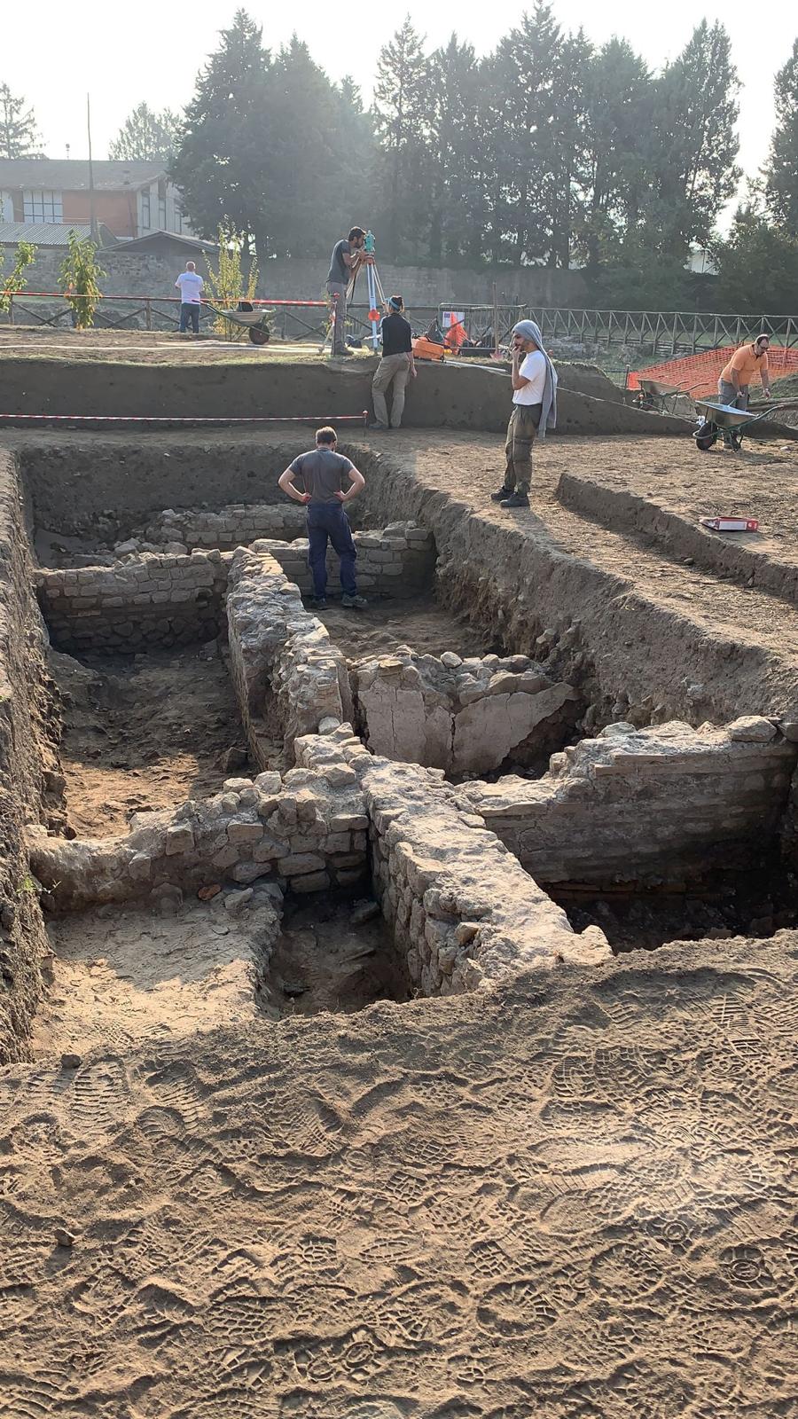
Preventive geophysical survey on a site of potential archaeological interest
Preventive Geophysical Surveys

We identify the invisible — supporting archaeologists and project teams.

We do not carry out the Archaeological Impact Assessment (VIA) — that is the responsibility of MiC-accredited archaeologists. We provide clients and their archaeological teams with non-invasive geophysical surveys (GPR, magnetometry, electrical resistivity) to read the subsurface before works begin, reduce uncertainties, and give technical substance to the reports required by the Soprintendenza (Italian Heritage Authority).

Our role

Geophysics in the service of preventive archaeology

The Archaeological Impact Assessment (VIA) is a technical document that must be prepared by MiC-accredited archaeologists. We do not produce it — our expertise is applied subsurface geophysics.

We step in upstream, providing the client with a preliminary geophysical reading of the area to frame archaeological risk, or immediately after the VIA, when the archaeologist or the Soprintendenza (Italian Heritage Authority) requests instrumental surveys on anomalies and areas of interest.

In both cases we deploy non-invasive technologies — GPR, magnetometry, electrical resistivity — professional instrumentation and georeferenced cartographic output, integrating fully with the appointed archaeological team.
The process

How we support archaeologists and clients

01

Area scoping

Analysis of context, known constraints and any documents already produced by the reference archaeologist or the Soprintendenza (Italian Heritage Authority).

02

Survey planning

Selection of the most suitable geophysical methods (GPR, magnetometry, electrical resistivity) based on objectives, target depth and site logistics.

03

Field acquisition

Extensive surveys with professional instrumentation and high-precision GNSS RTK georeferencing, coordinated with the archaeological team.

04

Processing & reporting

Anomaly maps, identification of potential buried features and a technical report ready for use by the archaeologist in their own deliverables.

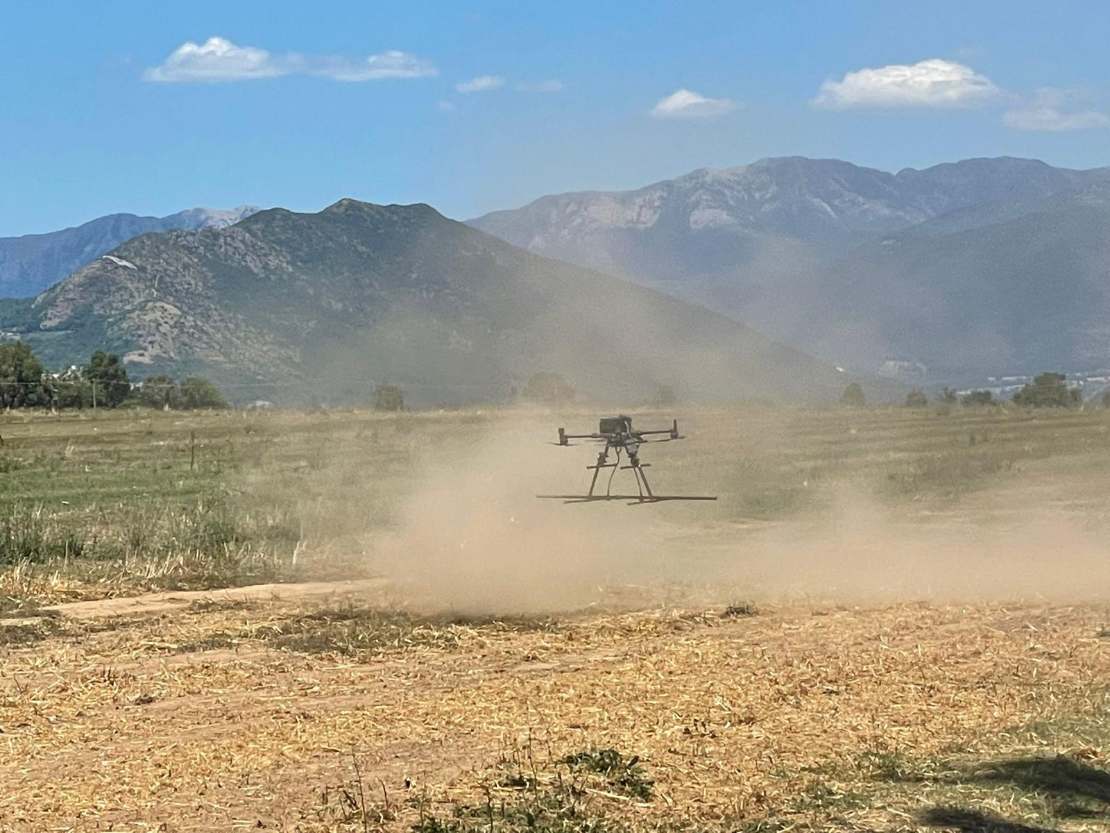
Magnetometry drone survey over investigation area
Useful documentation

What we need to plan the surveys

To correctly scope the work it helps to gather baseline documentation from the outset. We can liaise directly with the appointed archaeologist or the client to set up the survey in the most targeted way.

  • Cadastral map extract and project layout plan
  • Regional technical map (CTR) with project boundary
  • Any documents already produced by the appointed archaeologist
  • Archaeological and constraint map (PPR, PTPR)
  • Preliminary project extract and planned excavation profile
  • Any notes or requests from the competent Soprintendenza (Italian Heritage Authority)
Real cases

Project examples

Three representative scenarios across infrastructure, energy and construction in which preventive geophysical surveys provided the archaeological team and client with data that reduced risks, time and costs.

Infrastructure

Upgrade of an extra-urban road section in a hilly area

Surface area
12 linear km · ~80,000 m²
Methodology
Multi-channel GPR + magnetometry

Three archaeological anomalies mapped and delivered to the archaeological team: trial trenches focused only on flagged areas, with an estimated 40% saving on verification costs.

Energy plants

Solar farm on flat agricultural land

Surface area
~22 hectares
Methodology
Extensive magnetometry + targeted GPR

Georeferenced cartographic output used by the appointed archaeologist and the Soprintendenza (Italian Heritage Authority) to validate the plant layout avoiding sensitive zones.

Private construction

Residential subdivision in a minor historic centre

Surface area
~4,500 m²
Methodology
High-resolution 3D GPR

Buried masonry structures identified: building layout redesigned with in-situ preservation and no subsequent construction halt.

Frequently asked questions

Preventive surveys: what you need to know

Do you need preventive geophysical surveys?

Send us the key project data and we will reply with a dedicated technical and commercial proposal, coordinating with the archaeological team if already in place.

Contact us